Sunday, April 28, 2013

Milford Sound

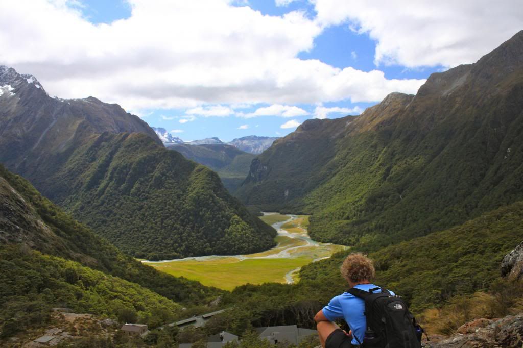
Fiordland National Park, where 
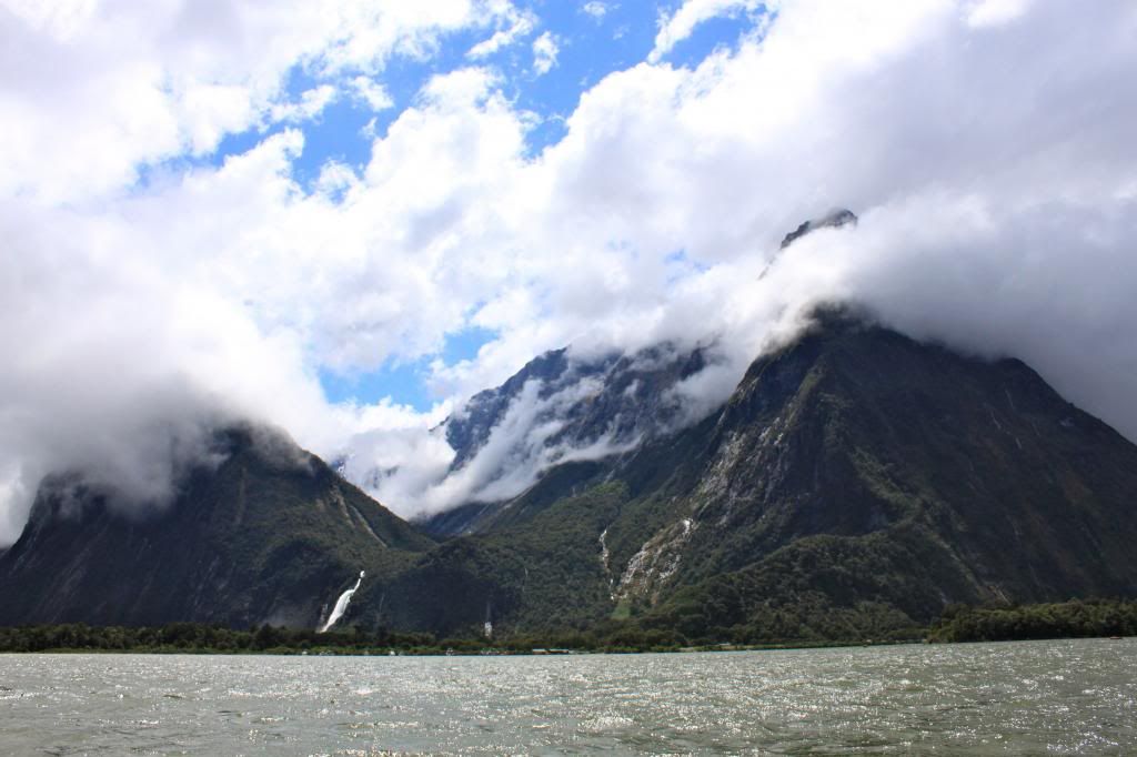
Milford Sound is located, is one of the top tourist destinations in New Zealand, attracting around 1 million visitors per year. We could not leave the South Island without seeing Milford Sound, but we did have to decide "how" we would explore the area. Essentially, we could get on one of the various boat tours that cruises around Milford Sound OR we could kayak around the sound. The latter option obviously would involve more work, but we thought that it would be a more interesting and unique way to see Milford Sound. Unfortunately, unlike our Abel Tasman kayaking experience, we could not find a way to rent kayaks unguided around Milford Sound. Therefore, we booked a tour with a group, Fiordland Wilderness Experiences. I actually wanted to book with a different company, Roscos, but they were fully booked by the time we got around to organizing our trip.
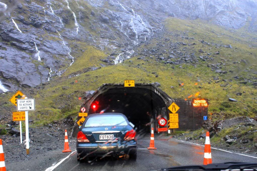
This is the tunnel to get to Milford Sound, Homer Tunnel. One way. No lights. Unpaved. Looks like it was just dug yesterday. It was quite an experience to drive through!
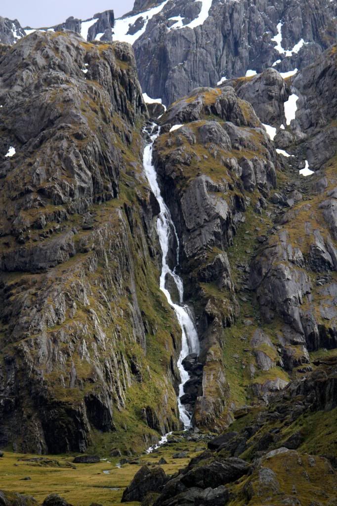
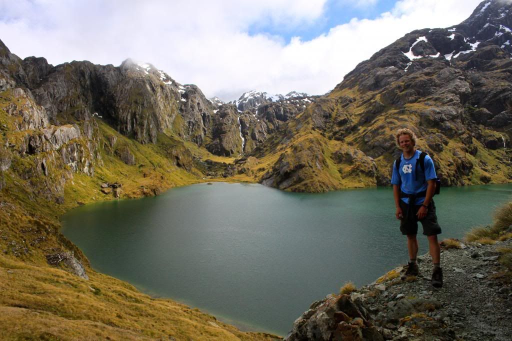
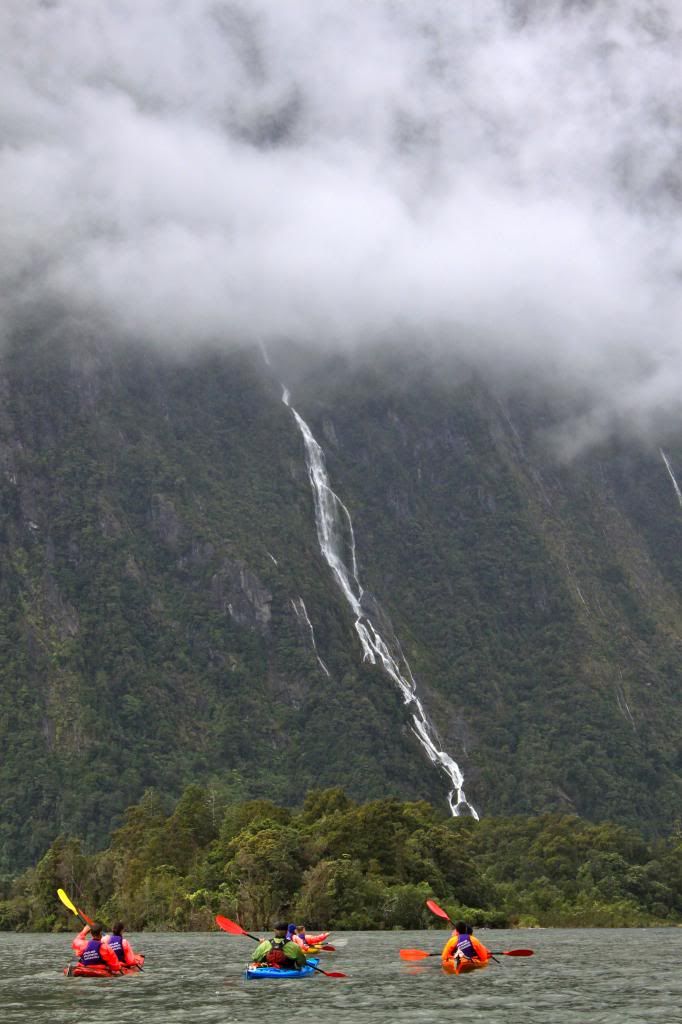
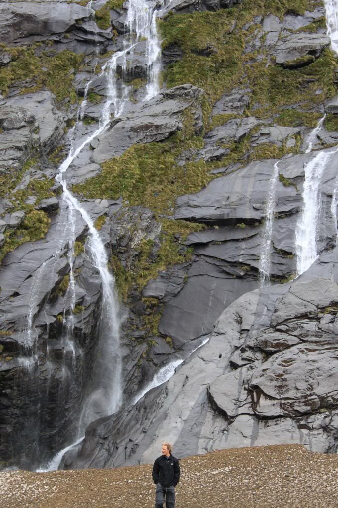
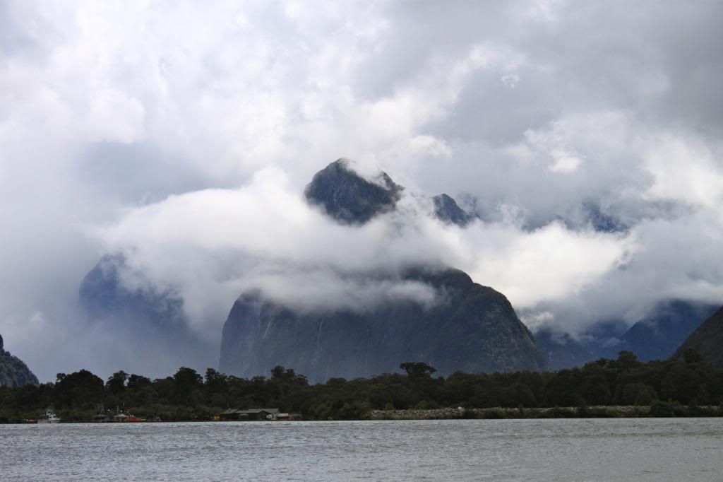
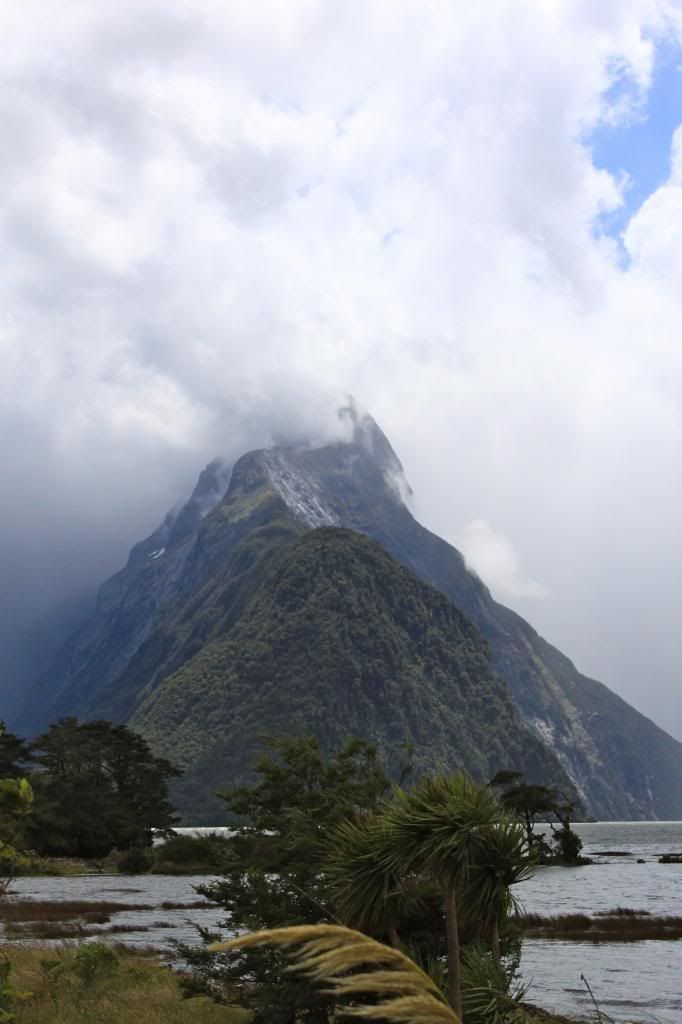
It rained the entire way to Milford Sound and it was still raining when we arrived at the lodge where we were meeting our group. However, our guide, Luke, assured us that rainy conditions were common and were, in fact, some of the best conditions due to the effect of rain on waterfall viewing. We loaded up into some cold weather gear and set out in our kayaks in a group of 9, including Luke. The first hour or so was the best, in my opinion. We got to kayak to the base of Lady Bowen Falls, where we could actually feel the falls pushing us back in our kayak. The next few hours were spent kayaking around the sound, enjoying awesome views of Mitre Peak, waterfalls, and an occasional seal.
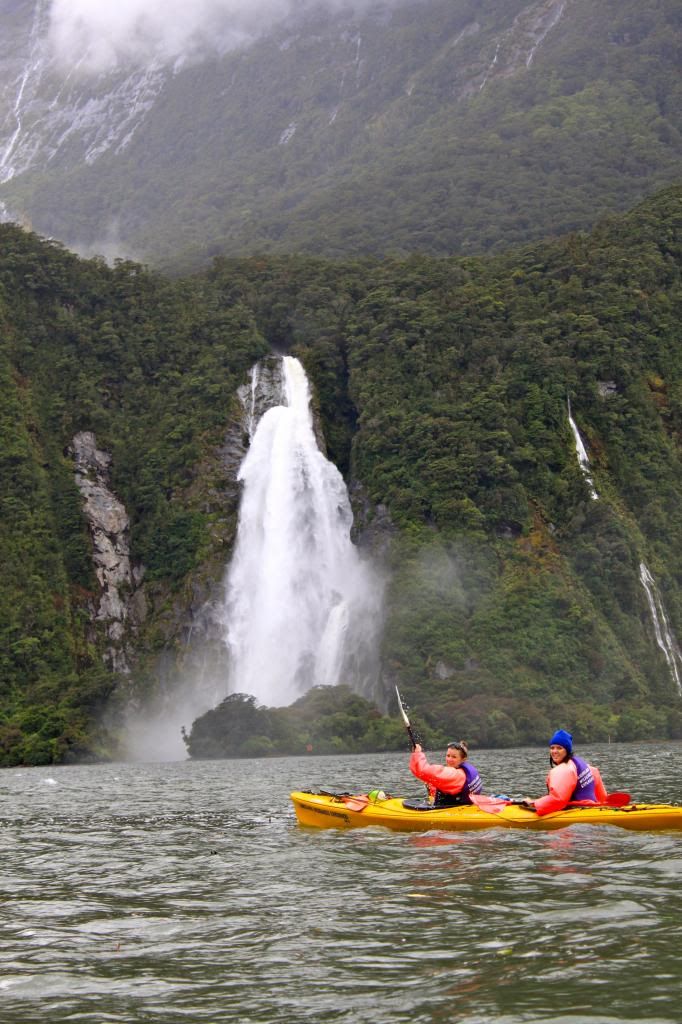
Carlie and her kayaking partner, Emma
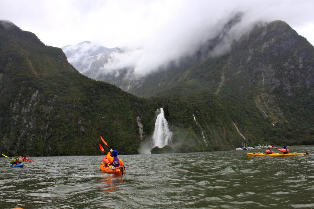
Our group heading towards Lady Bowen Falls
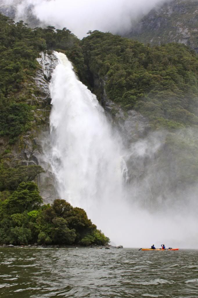
The sensation of being pushed back by the waterfall was crazy!
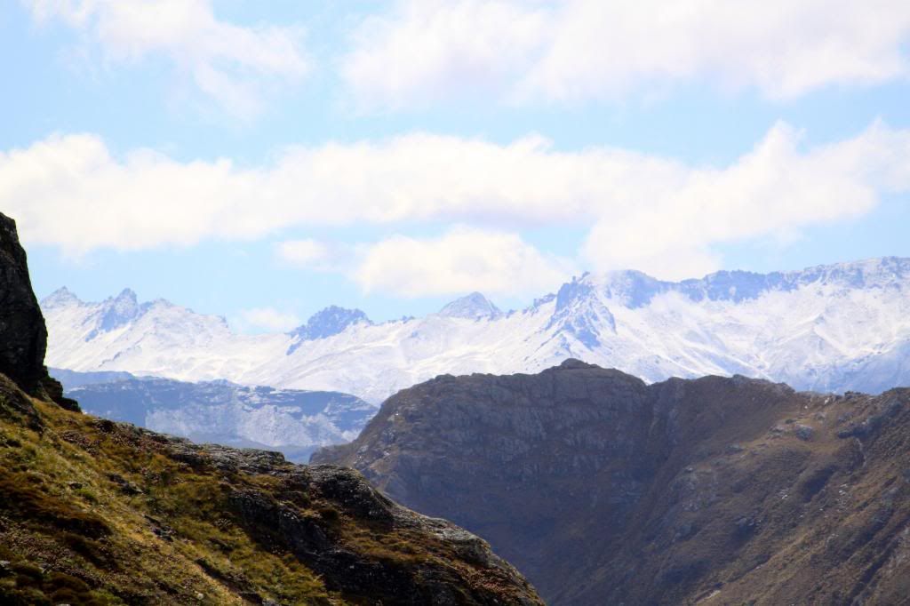
Many, many peaks...
...and lots of waterfalls!


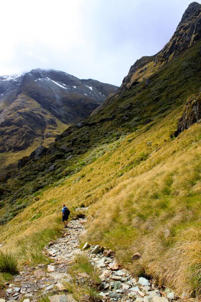
After we had been out for a few hours, the wind started to pick up and the conditions on the water were getting a bit rough. At that point, Luke decided that we would form a sail and try to sail back to our starting point. We have some hilarious video of this on the GoPro, but I have yet to go through the videos from our NZ trip, so I might have to share it at a later date! We formed a line of 4 kayaks, and the people on each end held one side of the sail, allowing us to glide without having to paddle. It was fun but it was freezing, because we were getting splashed by cold water and now that we were no longer paddling, we were not actually doing any work to generate body heat. Fortunately by the end of our trip, the sun was coming out, which helped to warm us up! We said goodbye to our group and hit the road back towards Queenstown, stopping along the way to check out a few more sights.
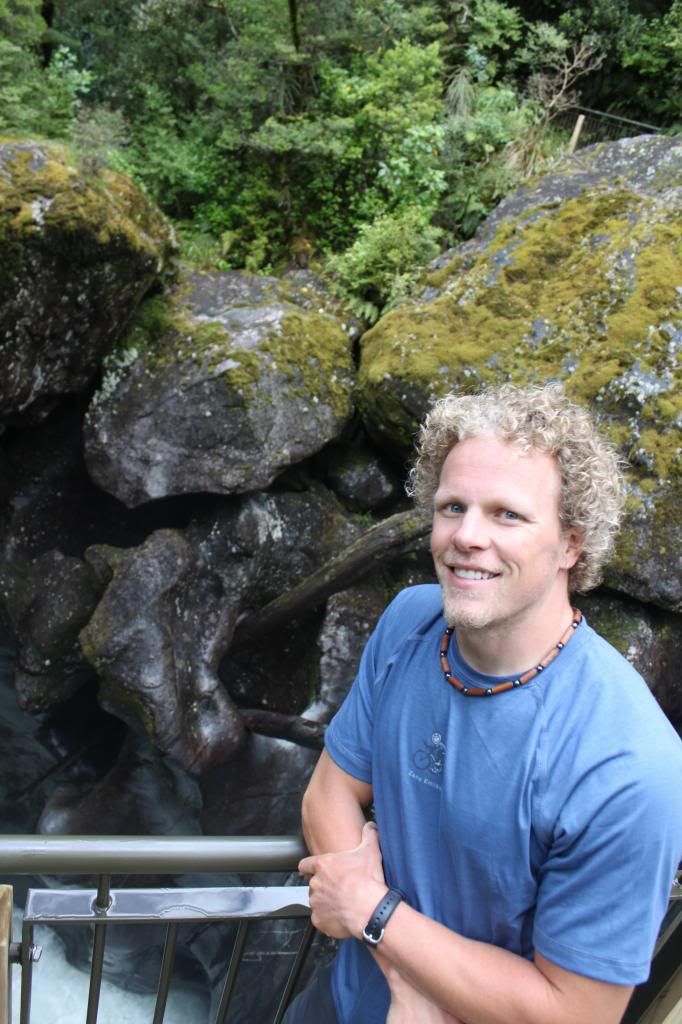
Erik at the Chasm, a spot where water has carved funky holes in granite rocks.
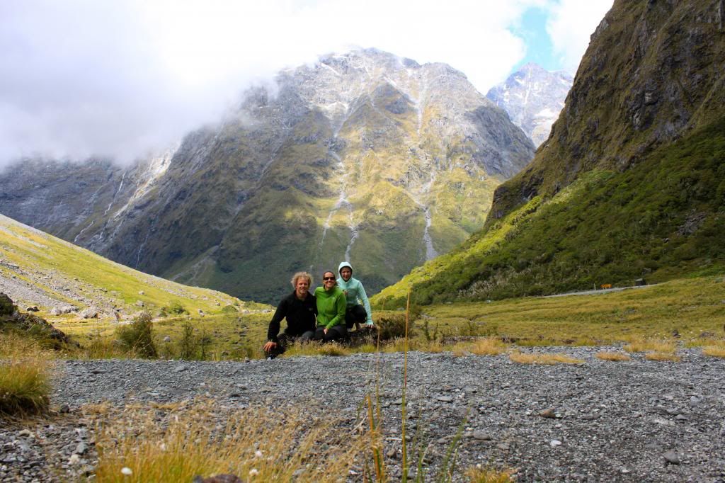
Family!
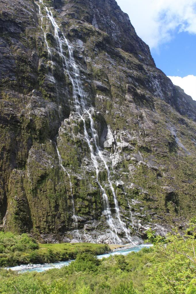
More waterfalls, this time right next to the road.


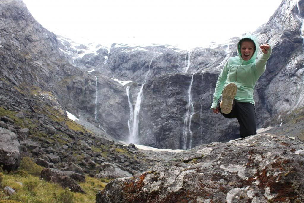
Carlie loves everything about Milford Sound!

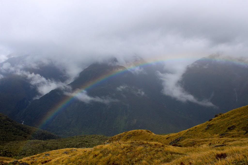
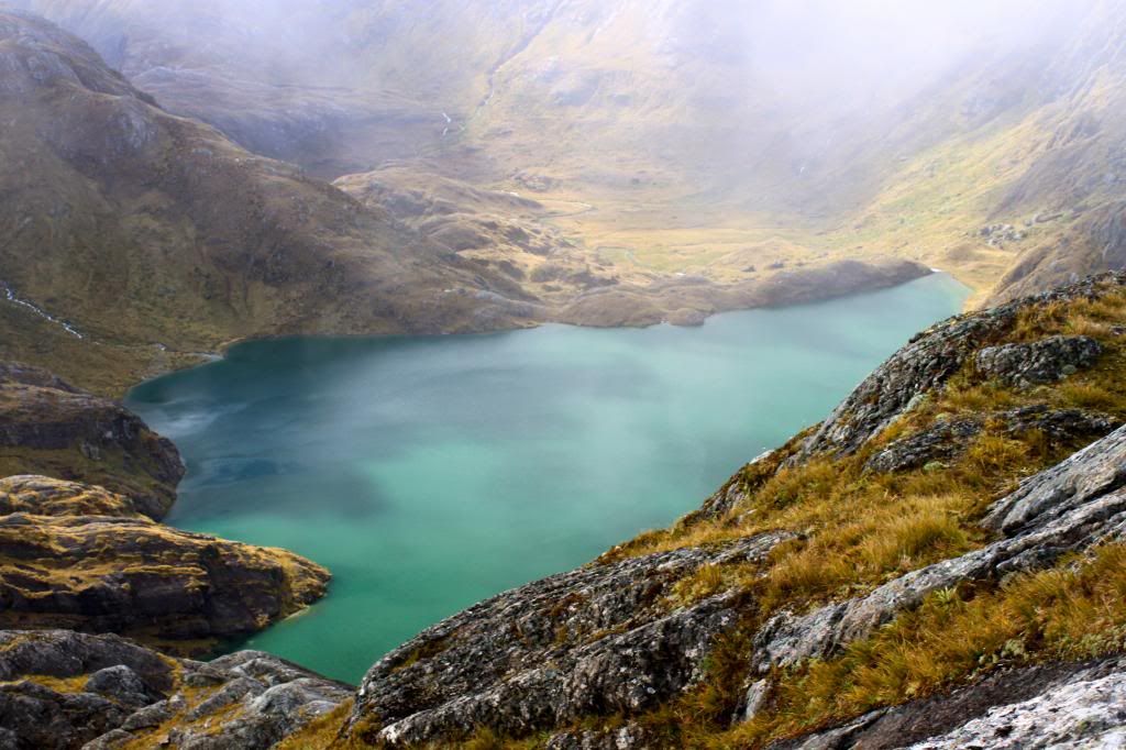
Pretty sweet views on the drive out!

About 15 minutes into our drive, we ran into stopped traffic. A tree had come down in the middle of the road and it ended up taking about 2 hours for them to get machinery in to move it! Fortunately, with the sun out, we were able to set up all of our camping gear in order to let it dry. That night we stayed in Queenstown at Bumbles Backpackers, a great place with fantastic lake views.

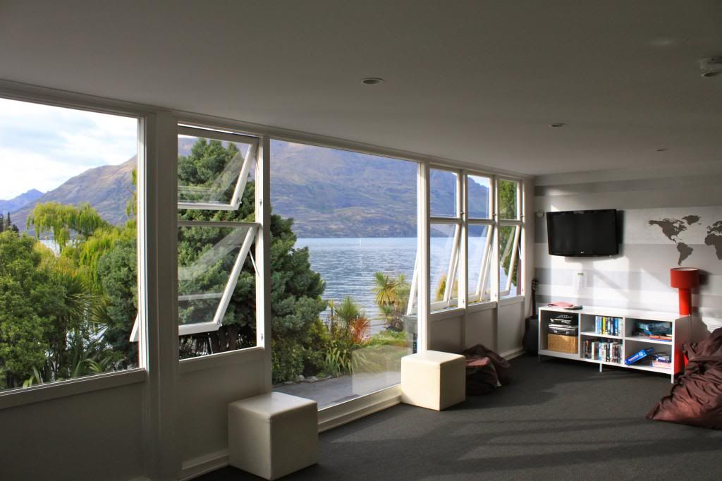
View of the lake from the lounge at Bumbles
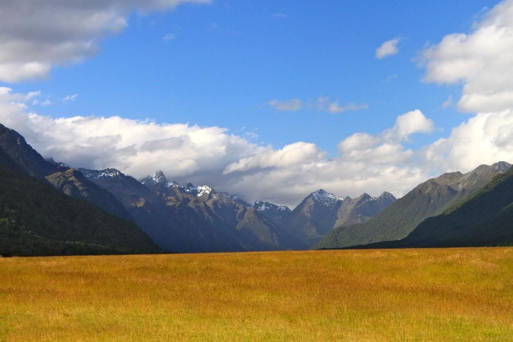
We were hoping that bungy jumping would be up and running for Carlie, but the water levels were still really high so that was not happening. Since that was the case, we decided to head to Wanaka for a second time, basically to spend some time with our friend, Mark.
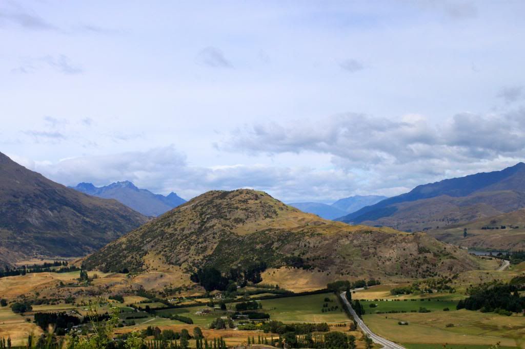
Looking back towards Queenstown on the drive to Wanaka.
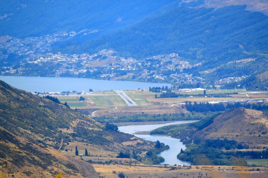
Queenstown. See the plane landing? This must be the coolest airport to fly into...surrounded by mountains!
Mark hooked us up with an amazing deal at the resort that he manages, where we got to enjoy working out at a fully equipped gym, swimming in the pool, and relaxing in the hot tubs. If you ever get to visit Wanaka, I highly recommend a stay at Oakridge Resort!
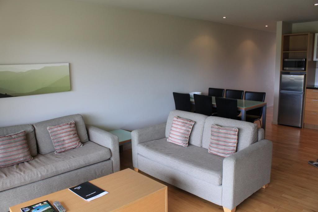
Living area and part of the kitchen in our 2 bedroom apartment
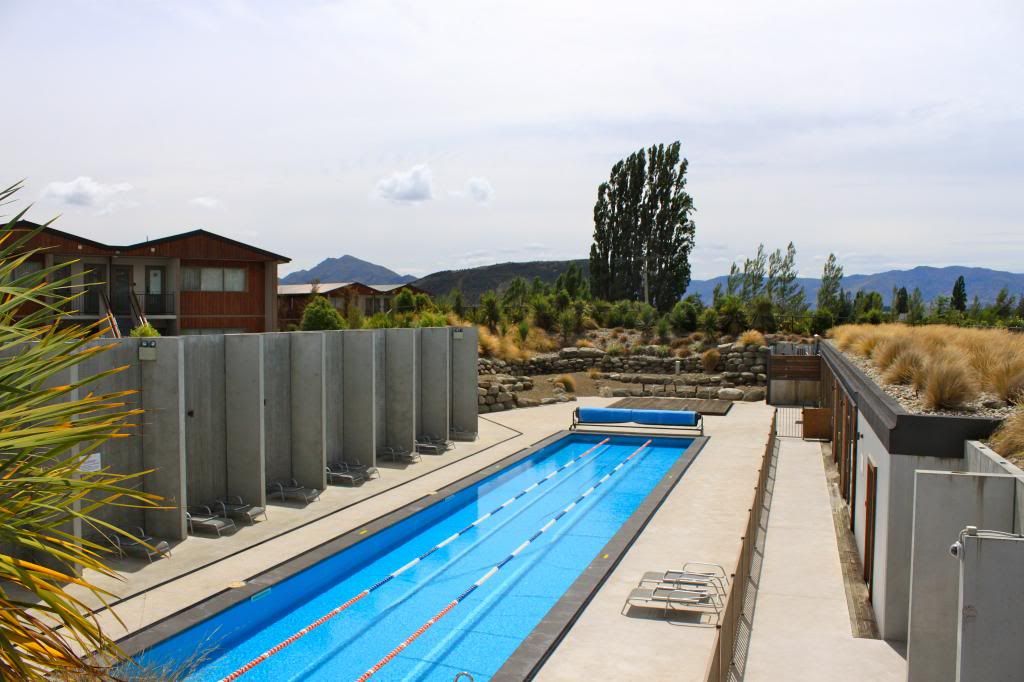
Lap pool

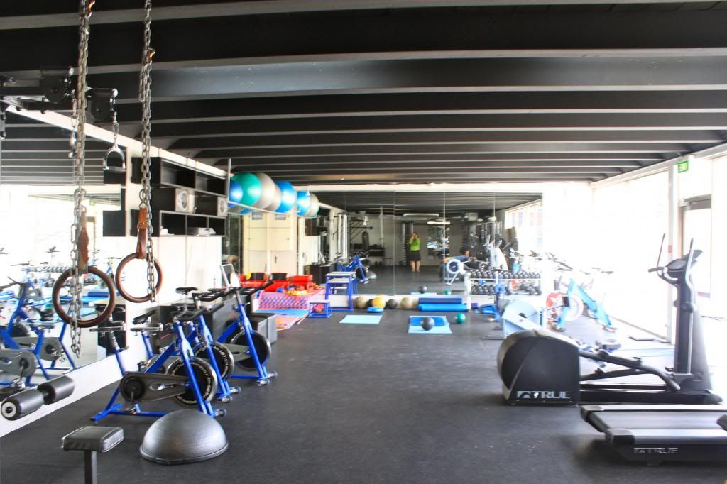
The best-ever hotel gym. Squat racks and pull up bars are behind me.

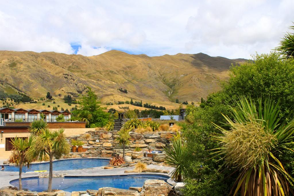
Who wouldn't want to spend time in those pools/hot tubs? There are 7 tubs to choose from, by the way!

That evening we went to see Skyfall (the new Bond film) at a small movie theater called Rubys. At Rubys, you order drinks before the movie, tell the bartenders when in the movie you would like your drinks delivered, and then they bring them to you! Also, you sit in large leather recliners in a small theater that seats about 25 people. It was a really unique movie-watching experience!


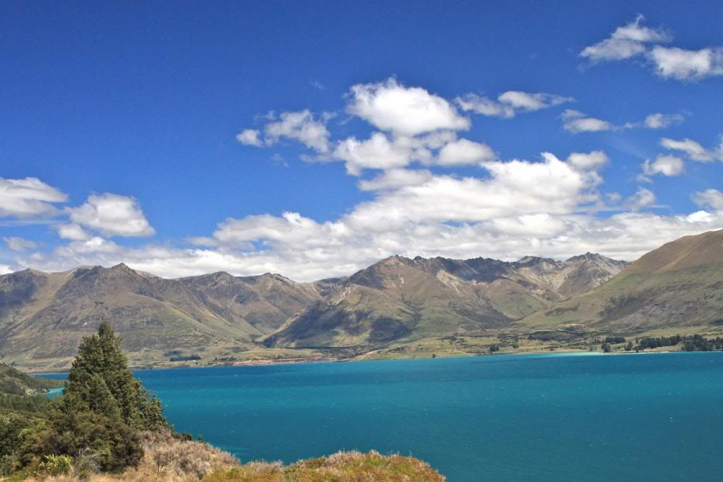
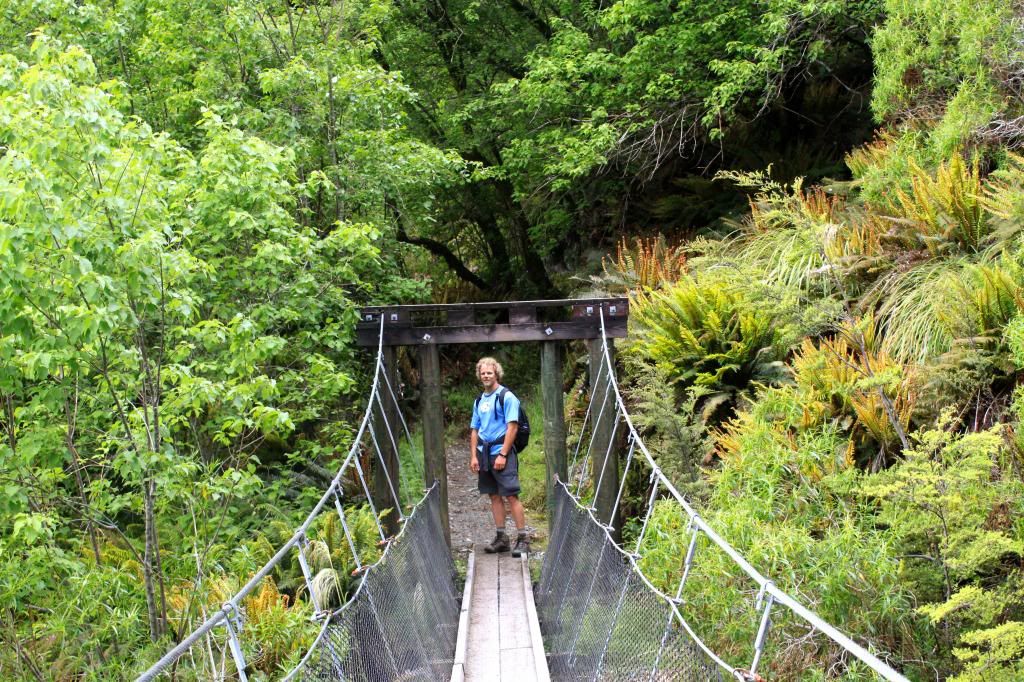
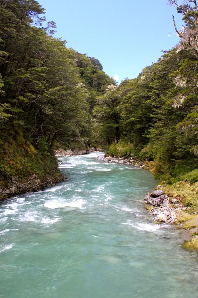
In the morning, we enjoyed the scenery in Wanaka, as Erik headed out for a mountain bike ride while Carlie and I took a long walk around the lake. Around midday, we said goodbye to Mark, our awesome accommodation, and the fantastic town of Wanaka before hitting the road to the West Coast.

Sunday, April 21, 2013

Adventures in Queenstown

After we finished our shortened version of the Routeburn Track, we headed straight to the airport to pick up Erik's sister, Carlie, who would be joining us for our last week in New Zealand. Unfortunately Carlie's bag did not make it with her, so we altered our plans for the next 24 hours in order to wait for her luggage to arrive. That night we had dinner at Fergburger, a place that Aussies and Kiwis rave about. Our burgers were good, but maybe a bit overrated considering we grew up in a country that knows how to do burgers! We stayed at Adventure Queenstown Hostel, where we spent the evening hanging out on the deck enjoying views of The Remarkables, a mountain range near Queenstown.


Carlie really wanted to bungy jump in Queenstown (home of the original bungy jump...which Erik did back in 2002 when he spent 6 weeks traveling around NZ), but due to recent weather (the crazy rain that caused us to modify our Routeburn Track hike), bungy jumping was not running. The Shotover Jet, a jet boat that is another popular "adventure" activity in Queenstown (the home of adventure activities!), was not running due to high water level, but they were hoping to start running the boats at 11am. We decided to give it a go even though there were warnings for people with head, neck, and back injuries due to the rough conditions. Our driver, Quinn, did a great job of making sure that we had fun on the Shotover. It helped that we had seats towards the front/side, so that when we went flying through the narrow canyon we felt like we were going to hit the rock walls while speeding by in the jet boat. My favorite part was the 540 degree turns that soaked us with water, of which Quinn did quite a few!


We spent the afternoon enjoying Queenstown before heading to the airport to pick up Carlie's bag, which arrived on the same flight she did, just a day later! At that point, we started our drive towards Milford Sound. The drive towards Milford provided us with breathtaking mountain views! Once we got close to Milford Sound, we started looking for a DOC campsite with available sites. There were a few along the way, but unfortuately we were finding that many were closed, again due to the recent heavy rains. Finally we found a site, Cascade Creek, that was a bit busy but certainly got the job done.
Gorgeous views of mountains and Lake Wakatipu!
Views approaching the Milford Sound area.
I had a slight obsession with these flowers at our campsite.

Time for some sibling bonding!
Ironically we ended up running into the two American guys who we met during our night of camping on the Routeburn Track. Small world! That night it rained A LOT. Thunderstorms, lightning, and heavy rain plagued our night of camping. Erik and I woke up to lots of rain in our tent. Carlie, fortunately, stayed dry. Despite the rain, we charged on to Milford, where a day of kayaking on Milford Sound awaited us!

Sunday, April 14, 2013

Routeburn Track

I just returned from a professional development trip to the Australian Institute of Sport, where a few Australian Olympians do their training. It was awesome, and I will certainly dedicate a blog post to that trip in a few weeks once I am caught up with all of our other adventures. For the first time in about 8 months, we have no "holidays" planned for the immediate future. Part of me is sad about that, as we have been fortunate to travel to many wonderful places in the last year or so, but the other part of me is excited to just be "home" for a little while. Melbourne itself has a lot to offer in terms of things to see and do, not to mention some great day trips within an hour or so drive of the city.

After leaving Wanaka, Erik and I headed to Queenstown, where we planned to pick up our camping/hiking permits for the Routeburn Track. This hike was one that had been planned months in advance because it is one of New Zealand's "Great Walks", meaning that campsites and huts along the route book out quickly. It is a hike that is meant to be done over 3 nights, but Erik and I thought that with our fitness level/experience we could hike it over 2 nights. When we arrived at the DOC in Queenstown to pick up our permits, we were greeted with this notice:

Great hiking and camping weather...not so much!! We were essentially advised NOT to do the trek due to the conditions, but I had REALLY been looking forward to doing the hike. At that point we were still undecided about what to do, so we went in search of waterproof pants. We both had good rain jackets, but not pants, and fortunately there are lots of good outdoor stores in Queenstown. With pants in hand, we got in the car all ready to go, but then we started hearing reports on the radio of roads being washed out and the weather getting worse. We called a hostel in Glenorchy, near the start of the hike, and the owner advised us to stay in Queenstown because he did not know if the roads would be open. At that point reality set in that we would not be able to do the hike as planned, but we would still hope for better conditions the next day. We then drove to Arrowtown, a quaint town close to Queenstown, where we found a comfortable hostel room for the night.
Main Street in Arrowtown, an old gold mining town.

We woke up to blue skies the next morning, so we decided to drive towards Glenorchy and start a modified version of the hike. When we arrived at the small general store in Glenorchy, we were told that the road to the start of the hike was open, but that we would need to be cautious on the way. It was still raining A LOT and we were told by the DOC that they did not know what the conditions of the trail past our campsite would be. We were a little frustrated due to the fact that so much was unknown about the trail being hike-able, so we decided to drive back towards Queenstown (where it was raining far less), to do a few short walks while we waited out the weather. We headed back to the general store mid-afternoon, prepped to start Routeburn, when we saw this sign:

Seriously?! A short phone call to the DOC let us know that the track was open on our end but closed on the other end, so we decided to give it a go. It was Erik's idea to spend one night on the track (where we originally intended to camp on the last night), then do a day hike to Harris Saddle and back down. It was as good of a compromise as we could make based on the circumstances. On our drive to the car park, it was pouring down rain, so we watched movies in the car until about 6pm, as long as we thought we could delay before hiking into our campsite in the rain.
I did not notice this sign until the morning when we woke up with our tent under some trees!
Despite the rain, the hike was nice. Moss covered trees, a raging river, gushing waterfalls, and a well-built track helped to pass the time. The trail was washed out in a few places, but it was nothing we could not get around. It took us about 2 hours to hike into Routeburn Flats campsite, where we set up camp and met a few friendly people, including a couple of American backpackers from the East Coast. We were told by the ranger that part of the track was still closed and they were not sure when it would re-open. That did not matter much to us, as our plan was to hike up to Harris Saddle and hike back down the same day, and the trail was open until that point, phew! We were picking up Carlie at the airport in late afternoon, so we were going to have to do some serious hiking to get up and down the mountain quickly.

We woke up early to light rain but packed up camp quickly and started the hike. We made it to Harris Saddle in less than 2.5 hours, where I hung out inside the shelter with a family who happens to live a few miles from us in Melbourne, while Erik hiked to the top of Conical Hill. This hike had it all...mountain views, waterfalls, lakes, flowers, rolling hills...it was extremely diverse. Even though we did not get the chance to hike the entire track, I feel like we had the opportunity to see some of the "best" parts of Routeburn.
The rain is good for something...waterfalls!
This was our first glimpse of Lake Harris, an alpine lake. Lake at the top of a mountain = amazing!
One of the water sources for Lake Harris
Spotted this rainbow when we were at Harris Saddle
Erik took this picture of Lake Harris through the clouds on his hike of Conical Hill.
Part of E's hike was on snow!
One more shot of the awesome alpine lake!
Sweet views of the Southern Alps
Heading down the mountain after our climb to Harris Saddle
The colors of the rocks along the track were amazing!
Looking out over where we camped the previous night.
This trail, like many NZ hikes, has lots of cool suspension bridges.
The water was much calmer on our way out compared to the day we hiked in!
Gorgeous views on the drive back to Glenorchy
While our Routeburn Track hike did not work out quite as we hoped it would, we still enjoyed the 24 or so hours that we spent on the track. Perhaps we will get a chance to hike the track in the future under better weather conditions!